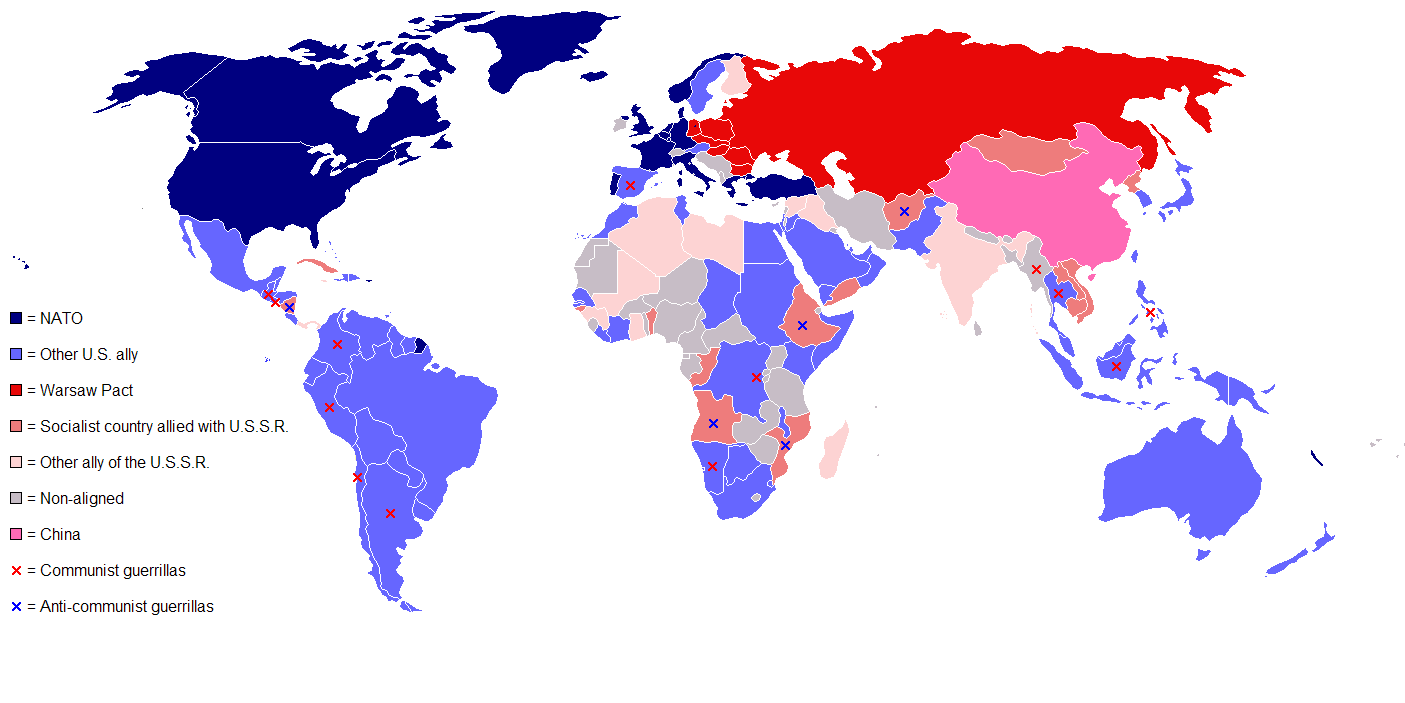
A nap of the old War sides in 1980.
The location[]

Morning fog in East Frisia near Moordorf.
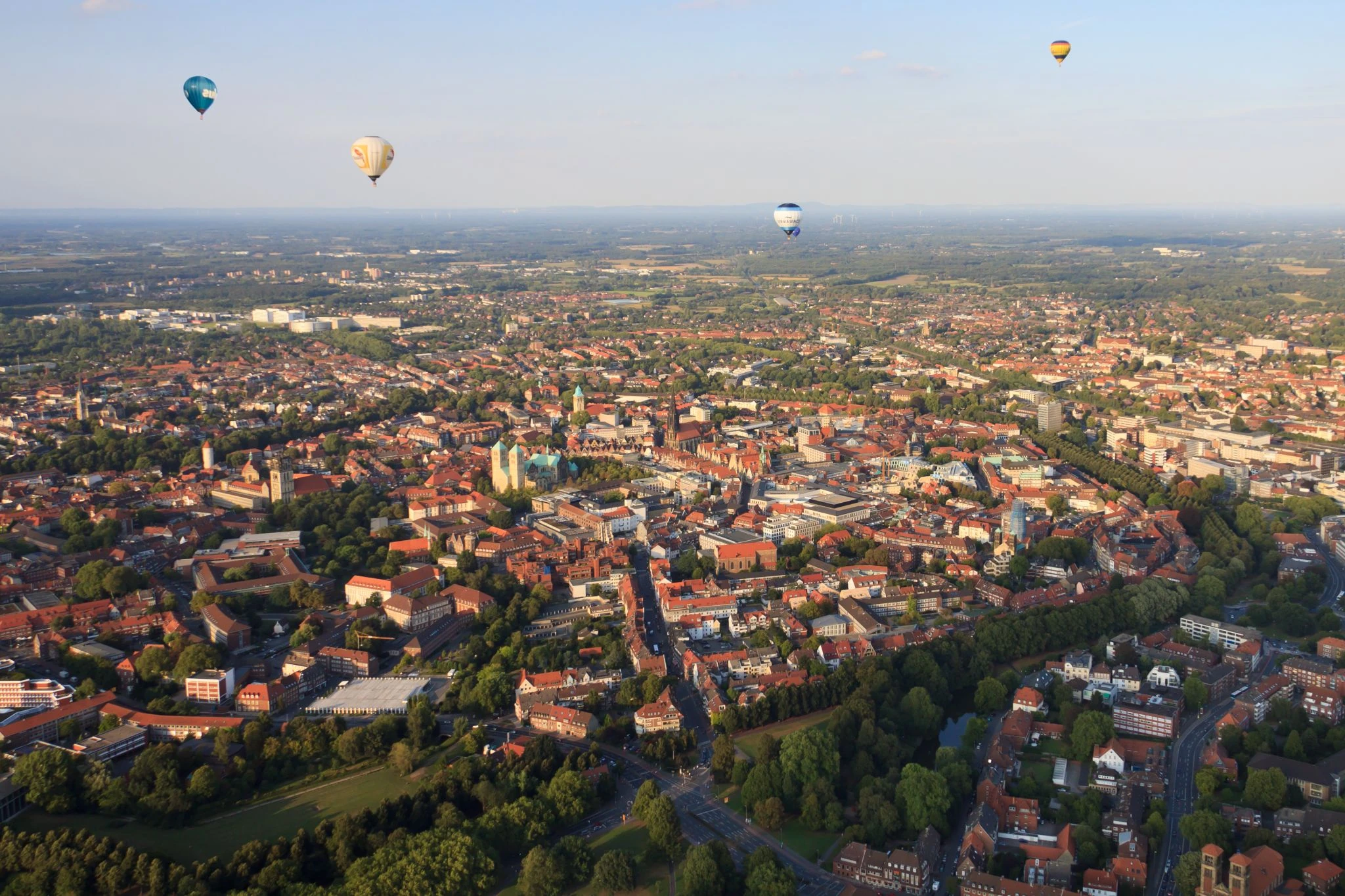
An aerial view of Münster on 27 August 2009.
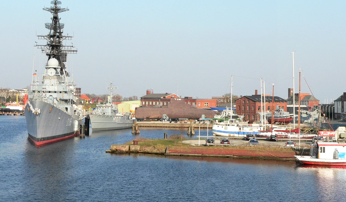
Wilhelmshaven Naval Museum in March 2007.
The aria is roughly encompassed by Lower Saxon Hills, the Teutoburg Forest, the Wiehen Hills, the Weser Hills, Lower Saxon Börde, the Westphalian Lowland, the Rhenish Massif, the Eifel, Northeast Mecklenburg Lowland, the Oder Valley, Bergisches Land, the Sauerland, East Brandenburg Plateau, Westphalian Lowland or Basin, Schleswig-Holstein Upland, East Frisian Geest, Upper Lusatian Plateau, Lower Rhine Plain, the Harz mountains, Kyffhäuser, Central Saxon hill country, the Ore Mountains, Szczecin Lagoon and the northern coastline with the North Sea and Baltic Sea.
It was formed during the Pleistocene era by glacial advances of terrestrial Scandinavian ice sheets. The region is drained by rivers that flow northwards into the North Sea or the Baltic. The important rivers Rhine, Ems, Weser, Elbe and Havel drain water from the North German Lowlands into the North Sea. This created woods in the rivers' flood plains and folds like the Spreewald ("Spree Forest"). Only a small area of the North German Plain falls within the catchment area of the Oder and Neiße rivers which drain out into the Baltic.
It has several distinctive salt marshes, tide-flats and tidal reed beds in the estuaries existed permanently in the tidal zone of the North Sea coast. Special micro-climates occur in bogs and heath-lands and, for example, in the Altes Land near Hamburg. The local variety of beach trees dominate in the remaining forested places, whilst other places have bountiful orchards. Human intervention caused the emergence of open heath such as the Lüneburg Heath and measures such as deforestation and the so-called Plaggenhieb (removal of the topsoil for use as fertilizer elsewhere) caused a wide impoverishment of the soil (AKA-Podsol). North-east Mecklenburg Lowland is also marshy in some coastal places to.
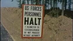
Border Protection - The Border Between East and West Europe - 1970's US Forces-1
Border Protection - The Border Between East and West Europe - 1970's US Forces.
The lowest points are low moorlands and old marshland on the edge of the ridge of dry land in the west of Schleswig-Holstein called the Wilster Marsh. It is 3.5 metres below sea level and prone to flooding in stormy weather. Similar terrain and depths are found in the north west of Lower Saxony at the Freepsum. 2.3 metres below sea level and prone to flooding in stormy weather. The highest points are the Vistula and Hall glaciation terminal moraines on the Fläming Heath which is 200 metres above sea level and the Helpt Hills which is 179 metres above sea level. It has a maritime to sub-maritime climate.
Wilhelmshaven was during the cold war and still is Germany’s only deep-water port and its largest naval base. The benefits of the access by a deep water shipping channel were already recognised at the end of the 1950s with the construction of the port’s first oil tanker jetty.

Helmstedt eine Stadt an der Grenze (1980)
Helmstedt in 1980.
The Border checkpoint Helmstedt–Marienborn (German: Grenzübergang Helmstedt-Marienborn), named Grenzübergangsstelle Marienborn (GÜSt) (border crossing Marienborn) by the German Democratic Republic (GDR), was the largest and most important border crossing on the Inner German Border during the Cold War division of Germany. It was one of the Warsaw Pact's prime targets and a critical assess point for the Eastern Bloc's invasion of West Germany.
The civilian toll would have been immense since it has several major towns and cities like: Lübeck- Population: 210,577 (2012), Hamburg- Population: 1.799 million (2012), Münster- Population: 291,754 (2012) and Osnabrück- Population: 165,021 (2012) in W. Germany, and Magdeburg- Population: 232,364 (2012) and Schwerin - population is 91,583 (2013) and in E. Germany.
The plan[]


The Soviet/Remnant Soviet flag.


The flag of the USA.

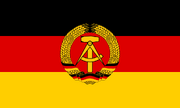
The East German flag.
The North German plain was identified as a geographic area which might be used as a Eastern Block major invasion route into Western Europe. Such a invasion Warsaw Pact forces would have led by the Soviet Third Shock Army and several East German border units. The heavily guarded Lower Rhine Plain was one of the top medium term objectives.
Unlike Germany's Fulda Gap, the plain's geography which makes it suitable for the deployment of armored and mechanized maneuver, so mass tank formations could vomit in to Germany and go on in to the Netherlands (AKA- Holland). This lead to it being identified as a slightly more significant risk.
Armed combat would have almost certainly hit the North German Plain, Germany's Fulda Gap and the The southern Danube route and the southern Danish Islands at about the same time.
The defense of the plain was the responsibility of NATO's Northern Army Group and NASTO's Second Allied Tactical Air Force.
NATO military strategists had the idea that they could drive in and take either Schwerin or Rostok in Mecklenburg and/or Magdeburg in Saxony-Anhalt if they struck first, but the odds were seen as to severe and that a defensive war to halt a Soviet invasion. The heavily guarded Oder Valley was seen as the furthest they could safely go. A NATO defective plan would be focused on holding the River Elbe Line and the city of Hamburg.
In either case there would have been a mass of tank battles, hundreds of thousands of fighting troopers, amassed air battles above, naval clashes of the northern coast, refugees and aerial bombings in such a clash!
Wilhelmshaven, Hamburg, Münster and Osnabrück were Soviet targets and the GDR had a major thrust planned Lübeck, which they wanted to annex ASAP.
Kiel, Flensburg and Idstedt all faced a triple whammy of E. Germans driving north, backed up by Soviet paratroopers and a few Polish vessels landing some troops on the coastline, while shelling any coastal defenses. In theory, who ever controlled the region could also drive up Sliezwig-Holstein in West Germany and conquer quickly Denmark, so the Soviet invasion of Denmark would inevitably occur.
One of the major targets was the northern part of Germany's Rhineland which had much coal, lead, lignite, magnesium, oil and uranium, as well as some building stone, iron ore, tin ore and lead deposits, in it. Cities and towns like Saarbrücken, Dortmund, Koblenz and Düsseldorf were major economic power houses in Napoleonic times, WW1 and WW2.
The Soviets would in theory go after Saarbrücken, Dortmund, Koblenz and Düsseldorf, but Saarbrücken could have got away with it due to being far enough away for the Soviets to tire or the NATO forces to hunker down before a later battle.
This represented a key part of NATO's "Red tanks rolling towards the North Sea" doomsday scenario of the early to mid 1960s, early 1970s and early 1980s. It was rightly assumed since the 1960s, that the Soviets would have also used large amounts of paratroopers here as well as tanks and nukes.
Battle Maps[]


The likely invasion rout and forces.


The likely invasion rout and forces.

The likely invasion rout and forces.
.
The forces[]
NATO[]
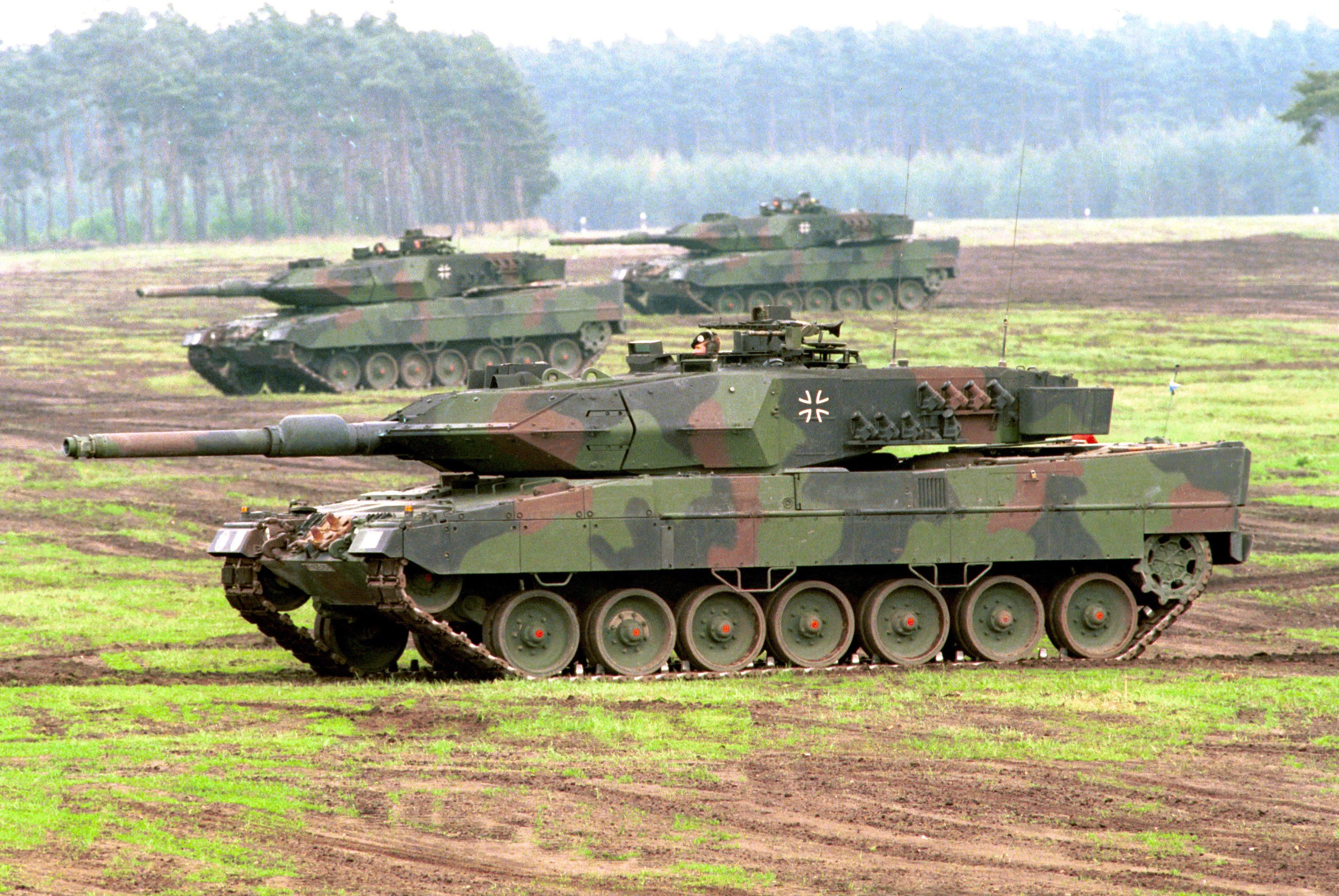

3 Leopard 2A5 tanks of the German Army (Heer). W. Germany also used them.
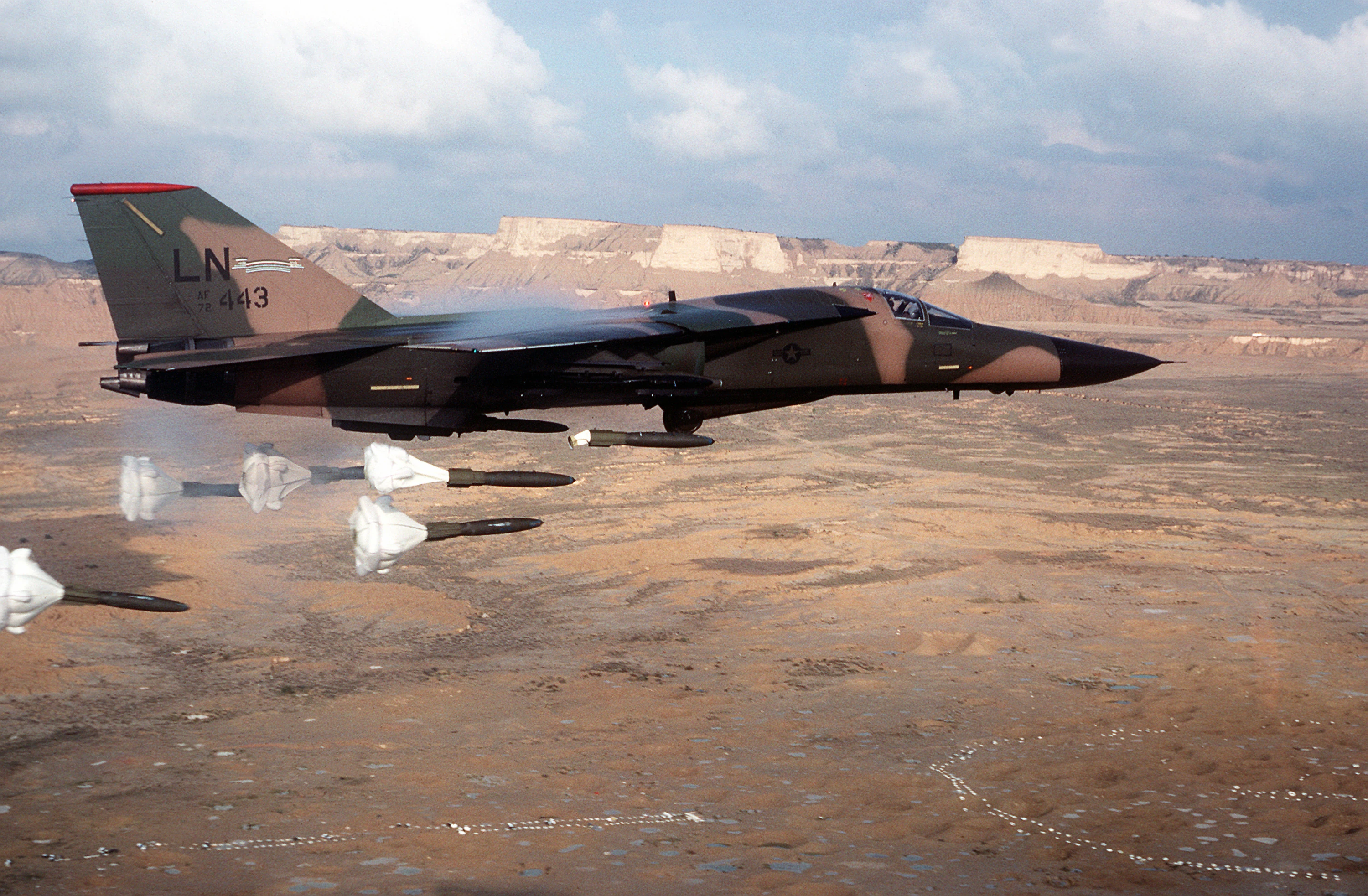
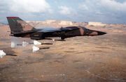
F-111F Ardvark dropping 'high-drag' bombs.
The defence of the Plain was the responsibility of NATO's Northern Army Group and Second Allied Tactical Air Force, made up of German, Dutch, Belgian, British and U.S. forces including 1st British Corps. It was tasked with providing air support to NATO's Northern Army Group (NORTHAG) by covering the Netherlands, Belgium, and Germany north of the city of Kassel and south of the Elbe river.
The British Army of the Rhine (BAOR) were at Osnabrück and RAF Rheindahlen, and the Americans were at Darmstadt, Ramstein Air Base and Münster amongst other places. Some Canadian units were in other places.
The command center was in the Netherlands at Joint Operations Center Maastricht (JOC Maastricht), but in 1983 NATO began with the construction of Static War Headquarters Castlegate in Linnich, Germany; as a replacement for JOC Maastricht. The back up War HQ was still located at Kanne in Belgium.
The Americans, British and W. Germans would have thrown the best weapons and techs in to the battle and made it a major conflict due to it's critical location.
American, British and W. German The B-52 Stratofortress bombers, Phantom FGR Mk 2s fighter bombers, Bo 105P/PAH-1A1 helicopters, Leopard 2A5 tanks and Tornado GR Mk 1s strike aircraft would have been used extensively.
Warsaw Pact[]
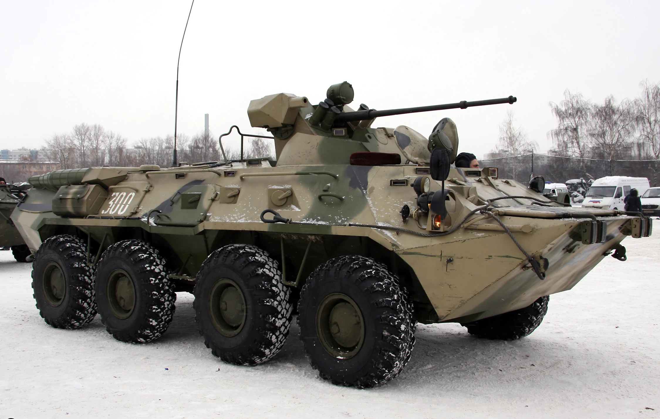
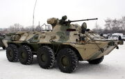
A Russian BTR-80A APC. The USSR also used them.
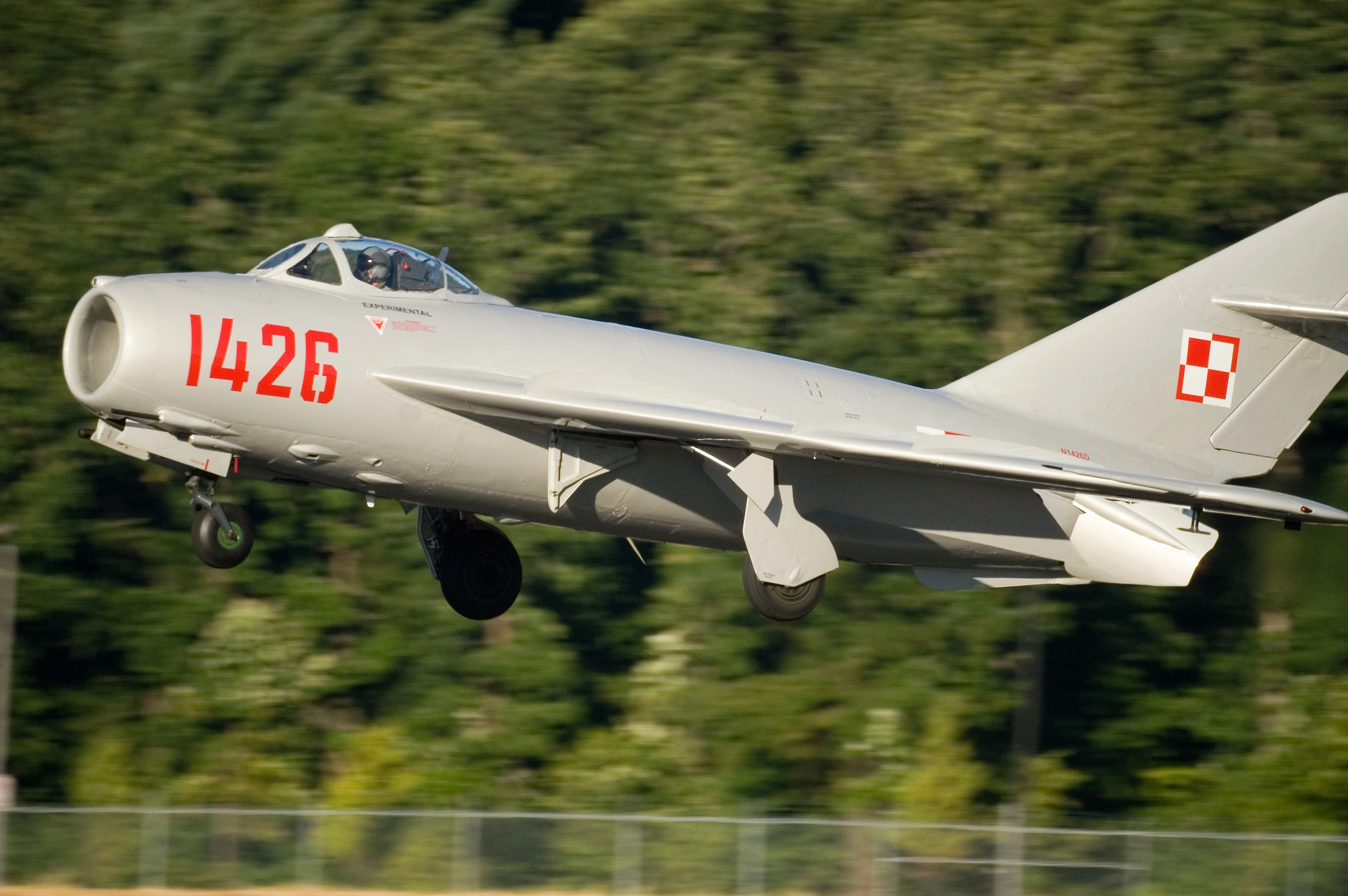
Restored MiG-17 in the markings of the Polish Air Force.
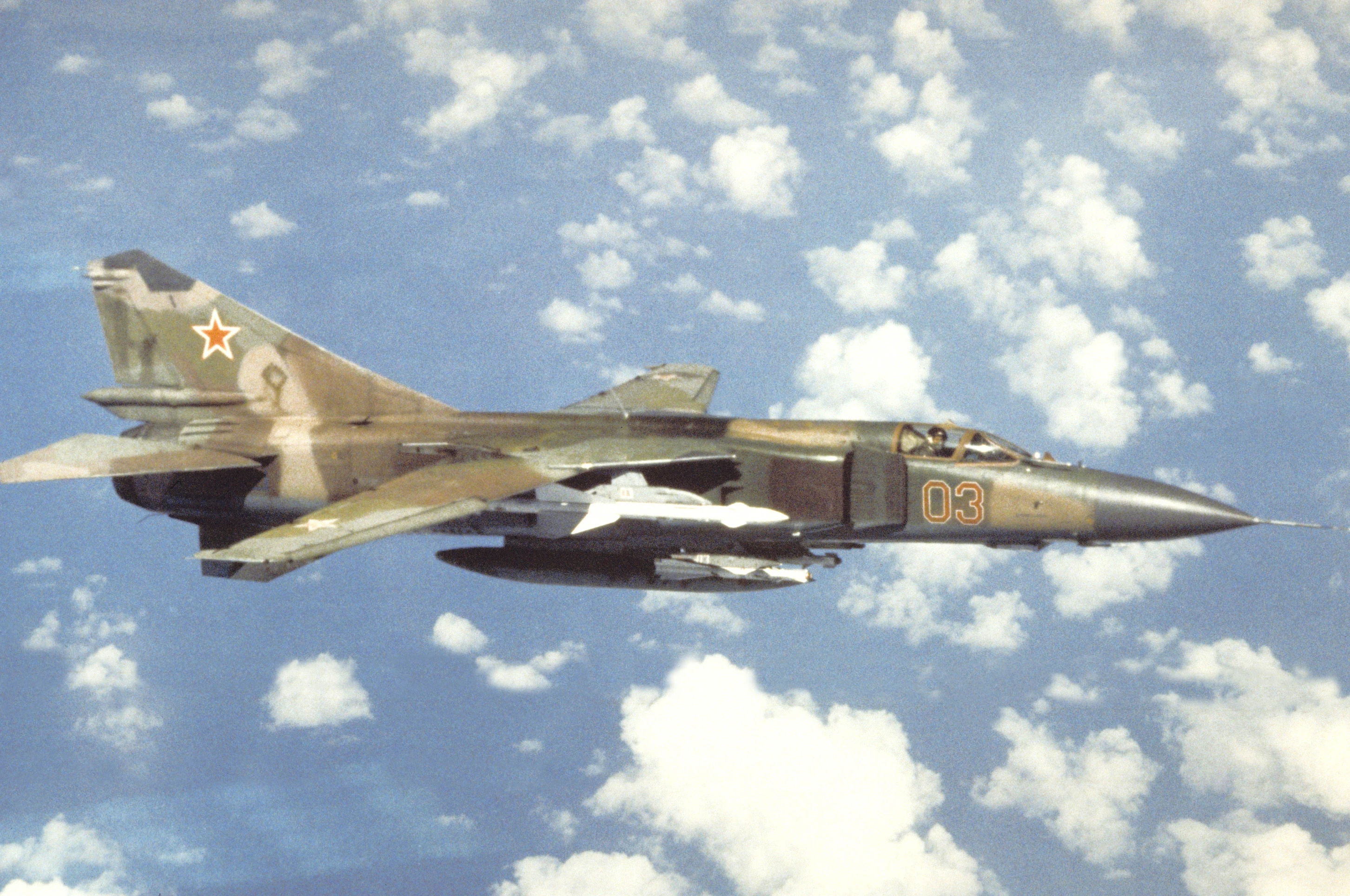

An air-to-air right side view of a Soviet MiG-23 Flogger aircraft. Exact Date Shot Unknown ~1 May 1989.
Such a invasion Warsaw Pact forces would have led by the Soviet Third Shock Army and several East German border units, followed up by more Soviets, any spare East German units and some initial Polish units.
Soviet air bases are at Jüterbog, Mirow/Lärz, Falkenberg, Merseburg, Mahlwinkel, Templin in East Germany. The Soviets had army bases at Dessau, Magdeburg, Zerbst Cochstedt, Neuruppin, Mahlwinkel, Schönebeck and Hillersleben.
There were Soviet/E. German army bases at Wünsdorf, then up to Vogelsang and Fürstenberg. Soviet/GDR airbases were at Jüterbog Airfield, Jüterbog-Damm airfield and Vogelsang. Several places like Neuestrellitz and Magdebourg had E. German army and air bases. The port of Rostock had a major E. Germany navel base in it.
The Soviets and E. Germans would have thrown the best weapons and techs in to the battle and made it a major conflict due to it's critical location.
I don't mean to be harsh, but Poland's long term role would have been low because it was then a bankrupt and Romania would have been even less useful since it was a laughably backward nation at that time. The GDR was much better off than Poland and the USSR despite being a giant de facto prison camp!
Soviet forces were huge, with 316 T-64BM tanks, BTR-80A APCs, 12 T-80B tanks and MiG-31 fighters would have lead the way.
Nukes[]
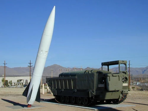
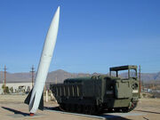
The MGM-52 Lance was a mobile field artillery tactical surface-to-surface missile (SRBM) system.
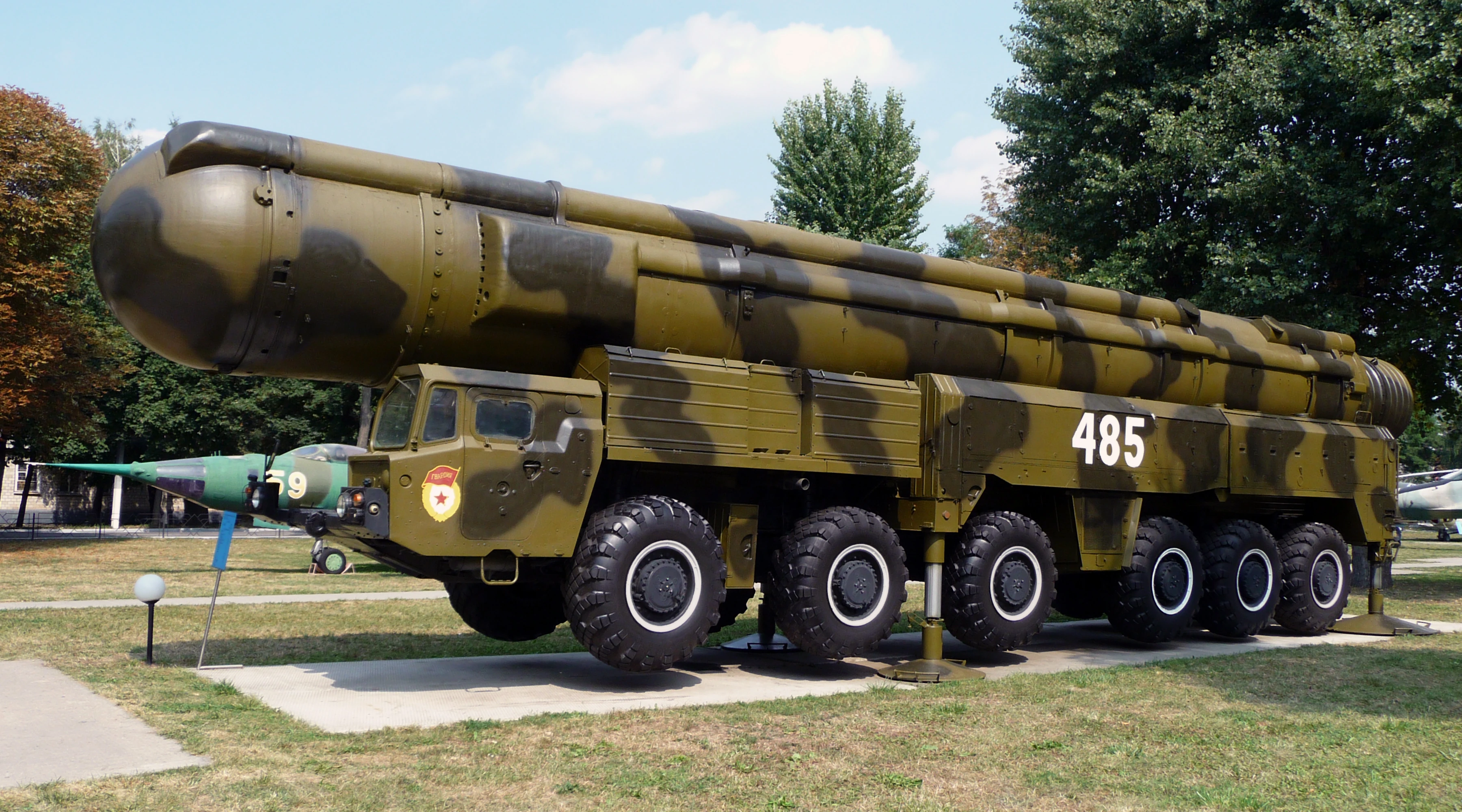

Intermediate-range ballistic missile with a nuclear warhead RSD-10 Pioneer. It was deployed by the Soviet Union from 1976 to 1988. NATO reporting name was SS-20 Saber. It was withdrawn from service under the Intermediate-Range Nuclear Forces Treaty.
In response to the quantitative superiority of the Soviet forces, the U.S. had tactical nuclear weapons for many years in the North German Plain. This was one of the more deadly aspects of the arms race.
The Americans had been issued with hundreds of high kill rate weapons like nuclear missiles, nuclear recoilless guns, the Davy Crockett tactical launcher systems and special atomic demolition munitions.
The UK's BAOR, which was based in Osnabrück, was formerly armed with tactical nuclear weapons.
A tactical nuclear weapon (or TNW) also known as non-strategic nuclear weapon refers to a type of nuclear weapon which is designed to be used on a battlefield in military situations. Tactical nuclear weapons were a large part of the peak nuclear weapons stockpile levels during the Cold War. Both sides had developed plans to use tactical nuclear weapons in the Gap.
This is opposed to strategic nuclear weapons which are designed to be used against enemy cities, factories, and other larger-area targets to damage the enemy's ability to wage war and kill thousands of civilians in the proses.
The Soviets countered NATO's nuclear option with there own missiles. Vogelsang had a major Soviet ICBM and SRBM base base.
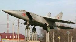
Many aircraft like the American B-52 Stratofortress bombers and Soviet Sukhoi Su-7 fighter-bomber/ground attack aircraft would be doping bombs, missiles and nukes on to the battle field as well.
Chemical warfare by most nationalities involved was fairly probable, but the likelihood of bio-weapons use by any-side was minimal.
Both halves of Germany were full of military bunkers and bases and would be devastated in both a nuclear and non-nuclear war!
Exercise Reforger[]
Exercise Reforger was created to plan for such an event.
Also see[]
- Finnish pseudo-neutrality
- Operation Square Leg (1980) and Exercise Hard Rock (1982)
- Germany's Fulda Gap
- Swedish pseudo-neutrality
- Seven days to the River Rhine (1979)
- French nuclear plans and the Force de Dissuasion
- The Swiss National Redoubt (1880-2010)
- Operation Northern Norway
- The southern Danube route
- Soviet/NATO invasion of Finland
- The week of war policy
- Operation Gladio
- Nicaraguan Civil War
- Korean Demilitarized Zone
- Red Army Faction
- Helmstedt–Marienborn checkpoint
- Berlin Wall
- Checkpoint Charlie
- Greece, Turkey and southern Italy
- River Elbe Line
- "Poland is 'toast'!"
- NATO command structures and HQs
Videos[]

The B-52 Stratofortress Bomber
The Boeing B-52 Stratofortress is a long-range, subsonic, jet-powered strategic bomber.
Mig-25 Foxbat (Rare Videos)
Mig-25 Foxbat (Rare Videos).

.jpg)
Links[]
- http://en.wikipedia.org/wiki/Osnabrück
- http://en.wikipedia.org/wiki/North_German_Plain
- http://en.wikipedia.org/wiki/Darmstadt
- http://en.wikipedia.org/wiki/British_Army_of_the_Rhine
- http://www.bbc.co.uk/news/magazine-20079147
- http://www.bbc.co.uk/news/magazine-20079147
- http://www.viralnova.com/hidden-german-bunker-gallery/01/
- http://en.wikipedia.org/wiki/Rhineland
- http://www.mining-technology.com/projects/rhineland/
- http://www.erih.net/nc/countries/detail.html?user_erihobjects_pi2%5BshowUid%5D=15819
- http://www.robinsonlibrary.com/history/history/worldwar1/rhine1919.htm
- http://www1.american.edu/ted/ice/saar.htm
- http://www.tripadvisor.co.uk/LocationPhotoDirectLink-g187393-i56160701-Mainz_Rhineland_Palatinate.html
- http://www.history.ucsb.edu/faculty/marcuse/classes/33d/projects/1920s/CarlosTreaty.htm
- https://isemodernworldhistorygrade9.wikispaces.com/From+the+Saarland+to+the+Rhineland,+1935-36?responseToken=0eb7222ca19ce38c481029396e8afc6df
- http://www.bbc.co.uk/bitesize/higher/history/roadwar/rhine/revision/1/
- http://en.wikipedia.org/wiki/Koblenz
- http://en.wikipedia.org/wiki/D%C3%BCsseldorf
- http://en.wikipedia.org/wiki/Saarbr%C3%BCcken
- http://en.wikipedia.org/wiki/Dortmund
- http://en.wikipedia.org/wiki/Wilhelmshaven
- https://medium.com/war-is-boring/this-is-how-the-world-could-have-ended-1ecd1db17ff2#.255fdrqjh
- http://coldwardecoded.blogspot.co.uk/2013/07/nuclear-war-in-west-seven-days-to-river.html