
The flag of Norway.
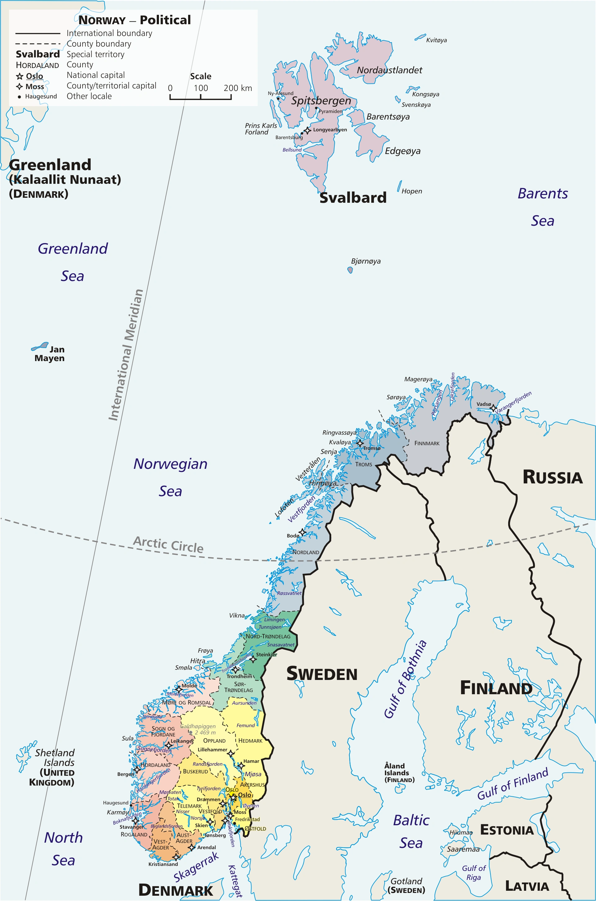
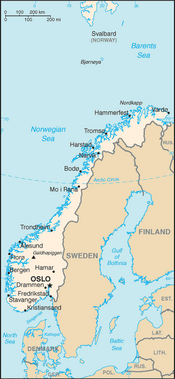
Note Finnmark county's location on the Russian border.
History[]
Spitsbergen Island (until recently the name was used colectivly for Svalbard Islands as a whole) was named by its discoverer, Willem Barentsz, in 1596. The name Spitsbergen, meaning “pointed mountains” in Dutch, but it is still tought that the Vikings may have got there first, but no proof of this was found so far.
The first verified discoveries of Jan Mayen, by three separate expeditions, occurred in the summer of 1614; but it is still tought that Medieval Irish Monks, Dutch explores and the Vikings may have got there first, but no proof of this was found so far.
A Danish-chartered company began sending whaling fleets to Spitsbergen from 1617 onwards.
The Island was empty except for the odd whaling ship and fishing boat until Vesteraalens Dampskibsselskab started tours to the Hotellneset in 1896. The American industrialist John Munroe Longyear later visited Spitsbergen as a tourist in 1901, where he met with an Norwegian/US/Russian joint expedition prospecting for coal. He returned to Spitsbergen 1903, where he met Henrik B. Næss in Adventfjorden and learned of then newly discover coal fields. In 1906, the Boston-based Arctic Coal Company, with Ayer and Longyear as the firm's main shareholders, started mining in Mine 1a, after having built docks and housing. The town of Longyearbyen is named after him. During the Cold War, Soviets, Swedes, Finns and Norwegians worked the Islands in an uneasy peace.
The Spitsbergen Treaty of 9 February 1920, the demilitarisation of the archipelago. The signatories were given equal rights to engage in commercial activities (mainly coal mining) on the islands. As of 2012, Norway and Russia are making use of this right.
Allied soldiers were stationed on the island in 1941 to prevent Nazi Germany from occupying the islands.
The USSR had also taken the Rybachy Peninsula off of Finland after the Winter War of 1939–1940 and then clashed with them later in World War 2 (WW2) over it.
No. 151 Wing RAF was based at Severomorsk between 1941 and 1942. Mermansk was also the main entry point in the region for American Lend-Leas goods in World War 2. Nazi Germany's German Kriegsmarine also used near by Kirkenes in Norway as a port and 11 local resistance fighters who helped the Norwegian partisans collect information about the German occupation forces were executed in the August of 1943.
Kirkenes is notable as it is the the terminus of Kirkenes–Bjørnevatn Line, which is the world's second-most northerly railway line. It is is used to transport Iron ore and mine workers between the two locations. Lake Bjørnevatnet was drained in 1958 so that the iron ore under the lake could be mined by the growing opencast mine which had opened near by in 1910. The iron ore was first discovered in 1866, but it was ignored for the next 40 years since it was not until the 1900s that new technology made it commercially viable. A failed attempt to extract it was made in 1903 and a successfully bid was made in 1906, which formally opened as a open cast mining operation in 1910. It got it's electricity supply from the Jarfjord Power Station, which was built in the early 1920s. At its peak, the mining company had a total of 1,500 employees and some of the pits are still in operation today, but others have closed over the years.
The USSR had also taken the Rybachy Peninsula off of Finland after the Winter War of 1939–1940 and then clashed with them later in World War 2 (WW2) over it.
No. 151 Wing RAF was based at Severomorsk between 1941 and 1942. Mermansk was also the main entry point in the region for American Lend-Leas goods in World War 2. Nazi Germany's German Kriegsmarine also used near by Kirkenes in Norway as a port and 11 local resistance fighters who helped the Norwegian partisans collect information about the German occupation forces were executed in the August of 1943.
The Soviet nickel mining town of Nikel (Russian: Ни́кель; Finnish: Kolosjoki) is a town in the Pechengsky District of Murmansk Oblast, Russia, located on the shores of Lake Kuets-Yarvi 196 kilometres (122 mi) northwest of Murmansk and 7 kilometres (4.3 mi) from the Norwegian border. Population: 12,756 (2010 Census); 16,534 (2002 Census); 21,838 (1989 Census); 18,000 (1973) It was founded by Finland in the early 1930's and taken over by the Russians in the Winter War. It is situated over a massive nickel reserve.
The location[]
Norway's side[]

Tromsø airport on midday in early January. Plane taking off from Tromsø airport. Photo taken at approx. midday in winter.


Blåtindan in Målselv, inland Troms. February 2009. 1,145 and 1,378 metres high summits of Blåtindan in Målselv commune as seen from near Storsteinnes in Balsfjord in 2009 February.
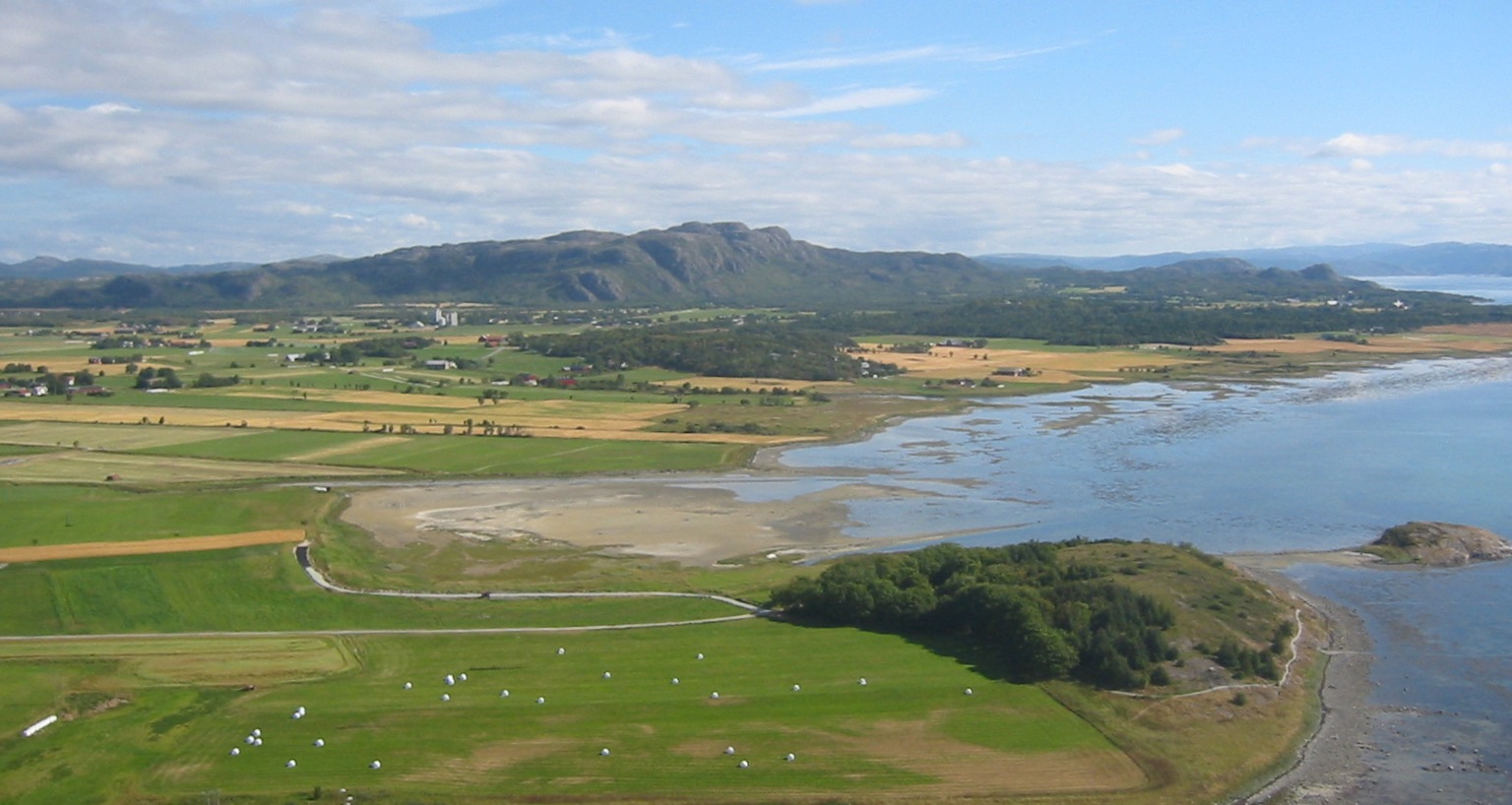

From Ørland (no:Ørland), Sør-Trøndelag Norway. Isle Bruholmen and parts of Austrått and Rusaset.


One of the old open-pit mines at Bjørnevatn. The bron hills in the background are covered in heather, grass or other similar tundra vegetation. The trees live on due to the protection given by the mine's pit.

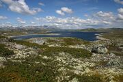
Hardangervidda, Norway. The Hardangervidda is a mountain plateau ("vidda" in Norwegian) in the Hardanger region of western Norway.
The physical geography of Norway is dominated by several vast mountain ranges broken up by valleys and fjords carved in to it by ancient Ice-age glaciers. A a result of this, less than 10% of the country's area is arable, with the rest being mountainous. Multiple glaciers are the major cause for erosion, so terrain in the Norwegian mountains consists of plateaus and lakes with peaks. These areas have abundant and diverse fauna and flora.
The centre and eastern part of Finnmark is generally less mountainous than the land roud Troms and Tromsø , and has no glaciers despite of the subarctic climate. The land east of Nordkapp is mostly below 300 m (980 ft) and declines in to the flatter Kola Peninsular. Troms county has surprising greenery for the latitude, and the inner waterways and fjords are lined with birch forests, and further inland there are extensive pine forests and highlands around the rivers Målselva and Reisaelva. Big islands like Senja, Kvaløya and Ringvassøya have green, forested interiors and a barren, mountainous coastline, with smaller islands offshore.
The midnight sun shines in Kirkenes from May 17 to July 21 and the corresponding winter daytime darkness extends from November 21 to January 21.
The Lofoten Islands are the peaks of a partly submerge mountain chain that jut out of the ocean as islands. From the mainland side it looks very barren and mountains, but behind the violet-black peaks there are also coastal and interior flatlands with good grazing for sheep, partially on soil made from decayed seaweed. The natural physical altitude of the tree-line is in reverse proportion to the latitude so that the tree-line is at sea level in northern Finnmark. The tree-line is also lower near the coast and higher on the eastern part of the mountains. The rugged Lofotens have a sub-polar oceanic climate and known for a distinctive type of scenery with mountains and peaks, open sea and sheltered bays, beaches, seanic places and mostly untouched lands.
Tromsø experiences a subarctic climate. About half of Finnmark is above the tree line and large parts of the other half is covered with small Downy birch. Tromsø has the mistaken reputation of accumulating a lot of snow in winter, but it is actually ice that mostly prevails in the area, especially in the first half of the winter. Tromsø's snowfall pattern is quite erratic and varies substantially between different winters. The Kola peninsular peninsula is covered by taiga in the south, an mix of tundra and trees in the east and only tundra in the north, where permafrost limits the growth of the trees resulting in landscape dominated by both shrubs and grasses. The Kandalaksha Nature Reserve was established to protect the population of Common Eider, is located in the Kandalaksha Gulf.
Harstad has a sub-polar oceanic climate with relatively mild winters and cool summer and mild weathers despite of being located north of the Arctic Circle It is protected from Atlantic gales by a mountain chain that is located near it's western flank. The city actually experiences warmer winters than major cities located 25 to 30 degrees farther south in latitude in the northern hemisphere such as Beijing, Chicago and Toronto. Average annual temperature is 3.9 °C (39.0 °F) (1961–90) and annual average precipitation is 850 millimetres (33.5 in). With high pressure weather, winter temperatures can get down to about −15 °C (5 °F), and in summer they can reach 27 °C (81 °F). Gressholman and many other small hilly islands lye of it's coast line.
Harstad's midnight sun is from 22 May to 18 July and the polar night lasts from 30 November to 12 January.
The Hardangervidda has a cold all year-round alpine climate. It is the biggest mountain plateau (the Norwegian for this is "vidda") in the Hardanger region of western Norway. It is the largest such plateau in Europe and hosts the site of one of Norway's largest glaciers. Much of the plateau is protected as part of a national park; it is a popular tourist,leisure destination and outdoor activities location. The night-time temperature can fall below below −30°C/ −22°F in the northern Alta Plateau.
Norway's Oceanic Islands[]
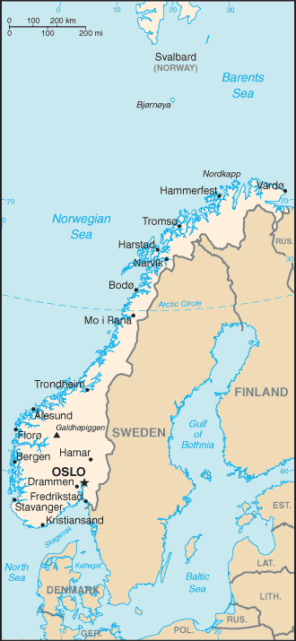
Map of Norway with countries south of Norway, Svalbard and Bjørnøya. See Image:Norway-map.png for a map without these areas.
The only inhabitants on Jan Mayen Island are the personnel working for the Norwegian Armed Forces Loran-C transmitter station and/or the scientists of the Norwegian Meteorological Institute. The winter population is only 18, but the summer population can be as high as 35. They either serve a six months or one year stint on the island, and crews are switched in April and October.
Gravel is Jan Mayen Island only exploitable natural resource and it was mined from the mining site at Trongskaret.
Jan Mayen, which is mostly a nature reserve, has a hyper-oceanic polar climate, similar to Greenland and Svalbard, with a Köppen classification of ET. Svalbard's climate is a combination of an Arctic climate (Köppen: ET) tempered by the North Atlantic Current and thussignificantly higher temperatures than other places at the same latitude. The flora on bath islands benefits from the long period of midnight sun, which compensates for the polar night. Both Islands are very mountainous.
Russia's side[]

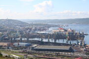
Murmansk Port.

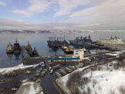
Severomorsk Navel Port.
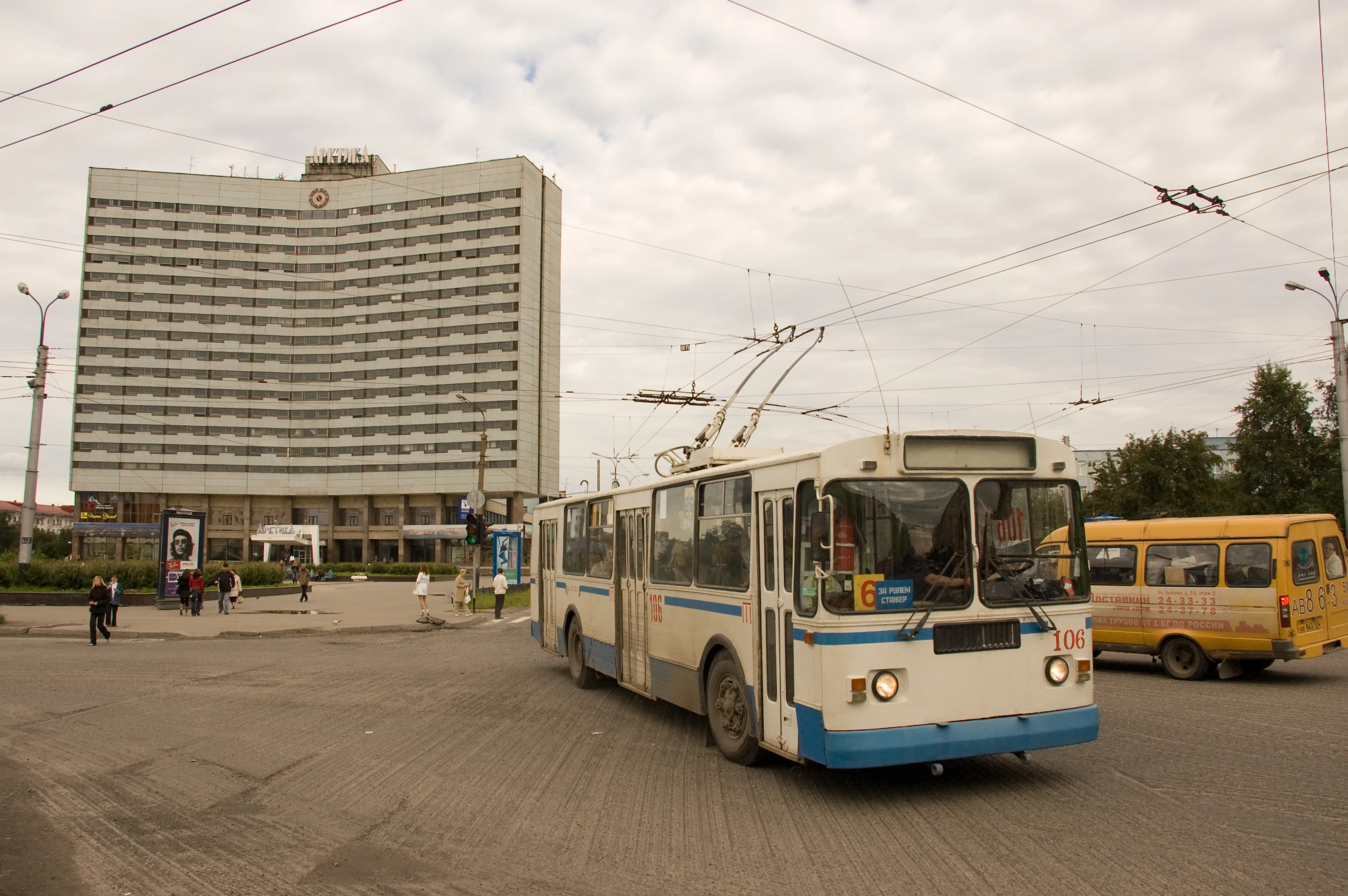
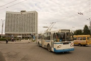
Murmansk trolleybus Ziu-682 with Hotel Arctic in the background.
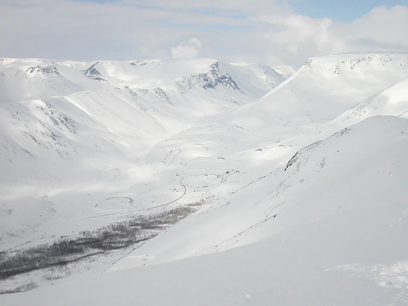
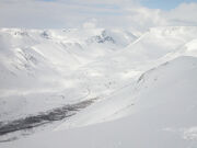
The Khibins Mountains in winter. The NATO forces would have difficulty flushing the Soviets out of here.


A dilapidated building on Rybachy (Rybačij) in 2008
The tundra covered northern coast of the Kola Peninsula is steep and high with steep sea cliffs, while the southern coast is flat, covered by taiga. and has only a few hills and the western part of the peninsula is dominated by the Khibiny Mountains and the Lovozero Massif. The north is also effected by permafrost which limits the growth of the trees resulting in landscape dominated by shrubs and grasses. The peninsula supports a small variety of mammals, and its rivers are an important habitat for the Atlantic salmon. The Kandalaksha Nature Reserve was established in the Kandalaksha Gulf to protect the population of Common Eider. The northern end of the Gulf Stream leads to unusually high temperatures in winter, but this also results in high winds due to the temperature variations between land and the Barents Sea.
The top soil is thin because the last ice age removed the top sediment layer of the soil of the Kola Peninsula (from Northern Sami: Guoládat; Russian: Ко́льский полуо́стров, Kolsky poluostrov) so the surface extremely rich in various ores and minerals, including apatites, nephelines, copper, nickel, iron ores, mica, kyanites, ceramic clay materials, as well as rare earth elements and non-ferrous ores. They are also deposits of construction materials such as granite, quartzite and limestone are also abundant. Diatomaceous earth deposits are common near lakes and are used to produce insulation. The vast apatite reserves were first exploited by the USSR in the 1920s, but this lead to a rapid and uncontrolled growth in industry, railways and population. It was heavily industrialized and militarized during the Cold War and is now ruined by nuclear waste and nickel smelting residues. The Pechenga River is heavily contaminated by heavy metals due to mining operations in the river basin.
Murmansk has a subarctic climate whic has both a long, cold winters and short, but relatively mild summers. In the city, freezing temperatures are routinely experienced from October to May. Average temperatures are between -7°C and +17°C depending on the time of year. However temperatures routinely plunge below −20 °C (−4 °F) during the winter. The average highs in July are temperatures at or slight exceeding +17 °C (63 °F). The city is slightly wetter during the summer than the winter, seeing an average of just under 500 mm (20 in) of precipitation each year.
The USSR had taken the hilly and tundra covered Rybachy Peninsula (in Russian: полуостров Рыбачий , Poluostrov Rybachi; in Northern Sami: Giehkirnjárga; in Norwegian: Fiskerhalvøya; in Finnish: Kalastajasaarento ) off of Finland after the Winter War of 1939–1940 and then clashed with them later in World War 2 (WW2) over it. The Rybachy Peninsula' most northerly point is Cape Nemetsky and the Peninsula's highest point is at 981 feet (299 metres) in hight. The climatologicaly Arctic-moderate Khibiny Mountains are rich in minerals due to the removal of a layer of soil during the last ice age. Removing the soil also made it useless for farming, as dose the cold.
The economy revolved around the Soviet Bases and breeding of reindeer, but oil extraction became a important new industry after 2003. It's geolagy consists of sedimentary strata created early Silurian Period of about 438 to 421 million years ago, considerably more recent than those of Kola. The Rybachy Peninsula separated from Kola Peninsula by the Gulf of Motovsky.
Near by Kildin Island is, gealogicly speaking, a tall granite mountain plateau, but most of the mountain is under water thus it ann island. It is up to 900 feet high in places and drops sharply towards the northern coast. The huge souther granite masses are carved by sea, frost and wind errosion into broad terraces. The interior is home to the brackish relict lake, Lake Mogil'noe (or Molginoye) and is home to unique species of cod (Gadus morhua kildinensis) that has adapted to it water type and hydrolagy.
The island is 10 miles long by 3.5 miles wide at the widest point.
According to the Norwegian Organization for the Protection of the Environment, the USSR in it's latter years and now Russia use it as a dumping ground for scrapped reactors from atomic submarines.
Ethnic mixture[]
As a whole, both the regions are multi-cultural, housing not just Norwegians but also the indigenous Sami people, Norwegian Finns (known as Kvens, distinct from the "Forest Finns" of Southern Norway) and Russian populations (mostly in Kirkenes) on the Norwegian side, and Norwegian, Russians, Finns, Sammi, Komi and Nennets on the Russian (ex-Soviet side). The Rybachy Peninsula was inhabited by Sami, Finns and some Karalians, by the time Novgorodian Russians settled it in the 13th century and took it over in 15th century.
The 8,000 (2013) strong climacticly continental subarctic town of Kirkenes (Finnish: Kirkkoniemi, Kven: Kirkkoniemi, Northern Sami: Girkonjárga, Russian: Киркенес) The town lies on a peninsula along the Bøkfjorden, an arm of the large Varangerfjorden. The region was viewed as a common Norwegian–Russian district until 1826, when the present border was settled. Most of of the inhabitants are of a Norwegian origins with a minority of Sami and mixed bloods. There are a few Finns, Kven recent Russian immigrants.
Both the the county and the city of Tromsø are named after the island Tromsøya on which it is located (Old Norse Trums). The Norse chieftain Ohthere, who lived during the 890s, had the northern part of his Viking fiefdom overlap the south of today's municipality of Tromsø.
Since 1932 the Russian state-owned Arktikugol Trust has been operating on Svalbard (it's on Spitsbergen Island proper, but the group of Islands used to use the name collectivity until recently as well). The bought it off of the Dutch between the World Wars. Longyearbyen was overwhelmingly ethnicity Norwegian at this time.
Mineral resources[]
Kirkenes is notable as it is the the terminus of Kirkenes–Bjørnevatn Line, which is the world's second-most northerly railway line. It is is used to transport Iron ore and mine workers between the two locations. Lake Bjørnevatnet was drained in 1958 so that the iron ore under the lake could be mined by the growing opencast mine which had opened near by in 1910. The iron ore was first discovered in 1866, but it was ignored for the next 40 years since it was not until the 1900s that new technology made it commercially viable. A failed attempt to extract it was made in 1903 and a successfully bid was made in 1906, which formally opened as a open cast mining operation in 1910. It got it's electricity supply from the Jarfjord Power Station, which was built in the early 1920s. At its peak, the mining company had a total of 1,500 employees and some of the pits are still in operation today, but others have closed over the years.
The Soviet nickel mining town of Nikel (Russian: Ни́кель; Finnish: Kolosjoki) is a town in the Pechengsky District of Murmansk Oblast, Russia, located on the shores of Lake Kuets-Yarvi 196 kilometres (122 mi) northwest of Murmansk and 7 kilometres (4.3 mi) from the Norwegian border. Population: 12,756 (2010 Census); 16,534 (2002 Census); 21,838 (1989 Census); 18,000 (1973) It was founded by Finland in the early 1930's and taken over by the Russians in the Winter War. It is situated over a massive nickel reserve.
The top soil is thin because the last ice age removed the top sediment layer of the soil of the Kola Peninsula (from Northern Sami: Guoládat; Russian: Ко́льский полуо́стров, Kolsky poluostrov) so the surface extremely rich in various ores and minerals, including apatites, nephelines, copper, nickel, iron ores, mica, kyanites, ceramic clay materials, as well as rare earth elements and non-ferrous ores. They are also deposits of construction materials such as granite, quartzite and limestone are also abundant. Diatomaceous earth deposits are common near lakes and are used to produce insulation. The vast apatite reserves were first exploited by the USSR in the 1920s, but this lead to a rapid and uncontrolled growth in industry, railways and population. It was heavily industrialized and militarized during the Cold War and is now ruined by nuclear waste and nickel smelting residues. The Pechenga River is heavily contaminated by heavy metals due to mining operations in the river basin.
The problem[]
The main sea route from the Kola Peninsula to the Atlantic Sea was along the Norwegian coast. It formed the access route to the coastal areas of the United States and the Western European countries, as well as a direct route to Iceland and Greenland. Both those islands had both tiny populations and a major NATO base on them, leading to them becoming prime targets of the USSR. The ultimate Soviet and now Russian goal was the probable "Soviet military interest zone" in the Norwegian Sea around Norway, Sptzbergen, S.E. Greenland, Iceland, the Shetlands and the Faero Islands. This area would be quickly filled up with Soviet ships and sub on various hostile duties.
The USSR was scared of an attack aimed at the Kola Peninsular which had the only ice-free Soviet military harbours in the region. They served the Soviet (now Russian) Northern Fleet, with seven naval bases, several shipyards, 200 mostly nuclear armed and/or powered submarines, many air bases and several related factories producing military equipment. About 75% of the Soviet Navy’s nuclear force was based here and many Russian nuclear vessels still are, but much less than in Soviet times.
The USSR had also taken the Rybachy Peninsula off of Finland after the Winter War of 1939–1940 and then clashed with them later in World War 2 (WW2) over it.
No. 151 Wing RAF was based at Severomorsk between 1941 and 1942. Mermansk was also the main entry point in the region for American Lend-Leas goods in World War 2. Nazi Germany's German Kriegsmarine also used near by Kirkenes in Norway as a port and 11 local resistance fighters who helped the Norwegian partisans collect information about the German occupation forces were executed in the August of 1943.
The Soviet nickel mining town of Nikel (Russian: Ни́кель; Finnish: Kolosjoki) is a town in the Pechengsky District of Murmansk Oblast, Russia, located on the shores of Lake Kuets-Yarvi 196 kilometres (122 mi) northwest of Murmansk and 7 kilometres (4.3 mi) from the Norwegian border. Population: 12,756 (2010 Census); 16,534 (2002 Census); 21,838 (1989 Census); 18,000 (1973) It was founded by Finland in the early 1930's and taken over by the Russians in the Winter War. It is situated over a massive nickel reserve.
The plan[]
The Soviet's Operation Northern Norway[]

A Russian T-80U at the Kubinka museum. The Soviets also used them.
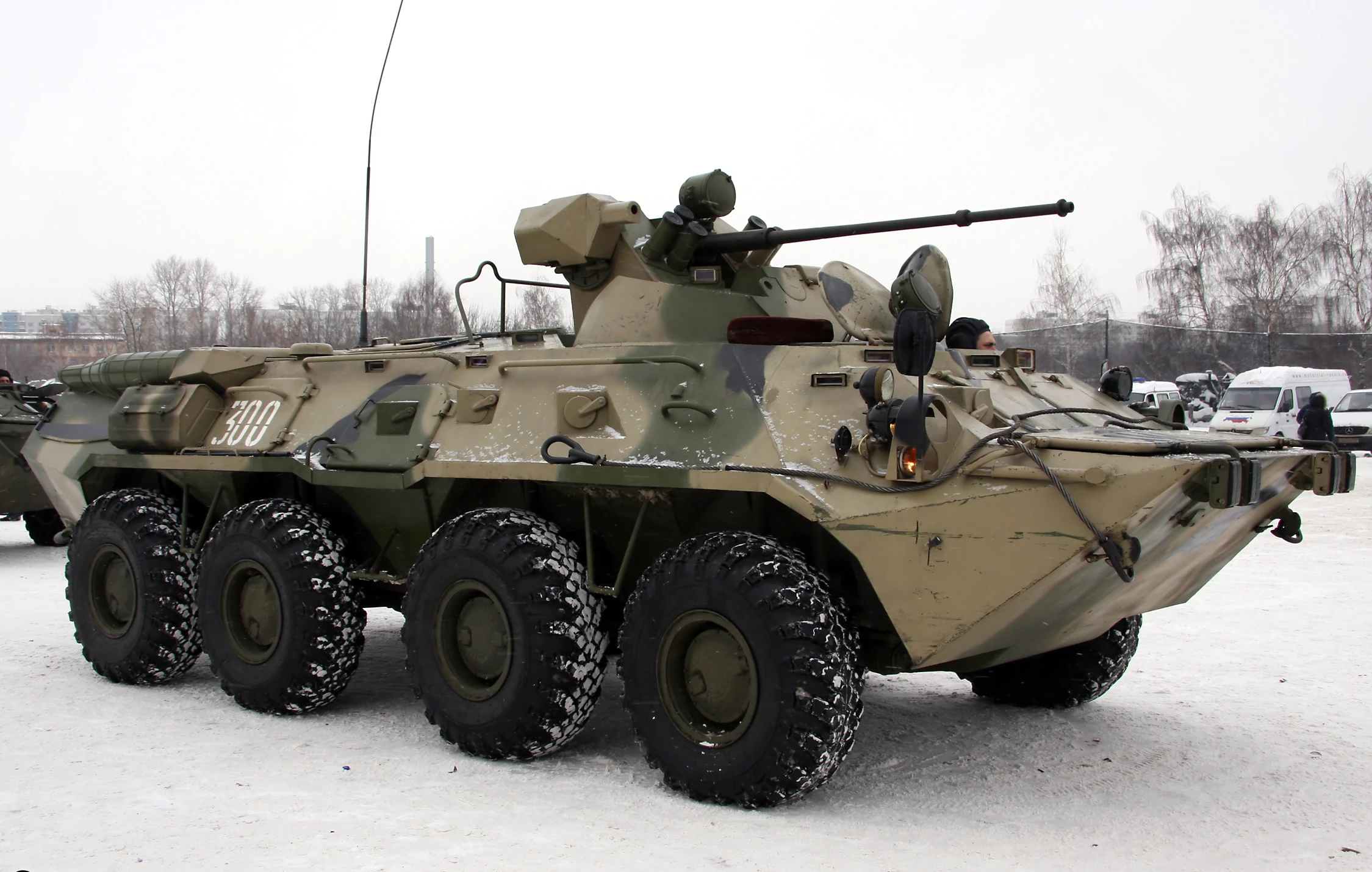
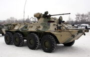
A Russian BTR-80A APC. The USSR also used them.
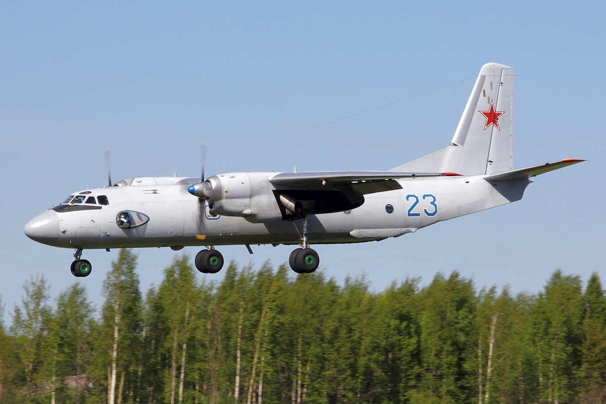

Russian Navy Antonov An-26 Dvurekov-5. The Soviets used them in the cold war.
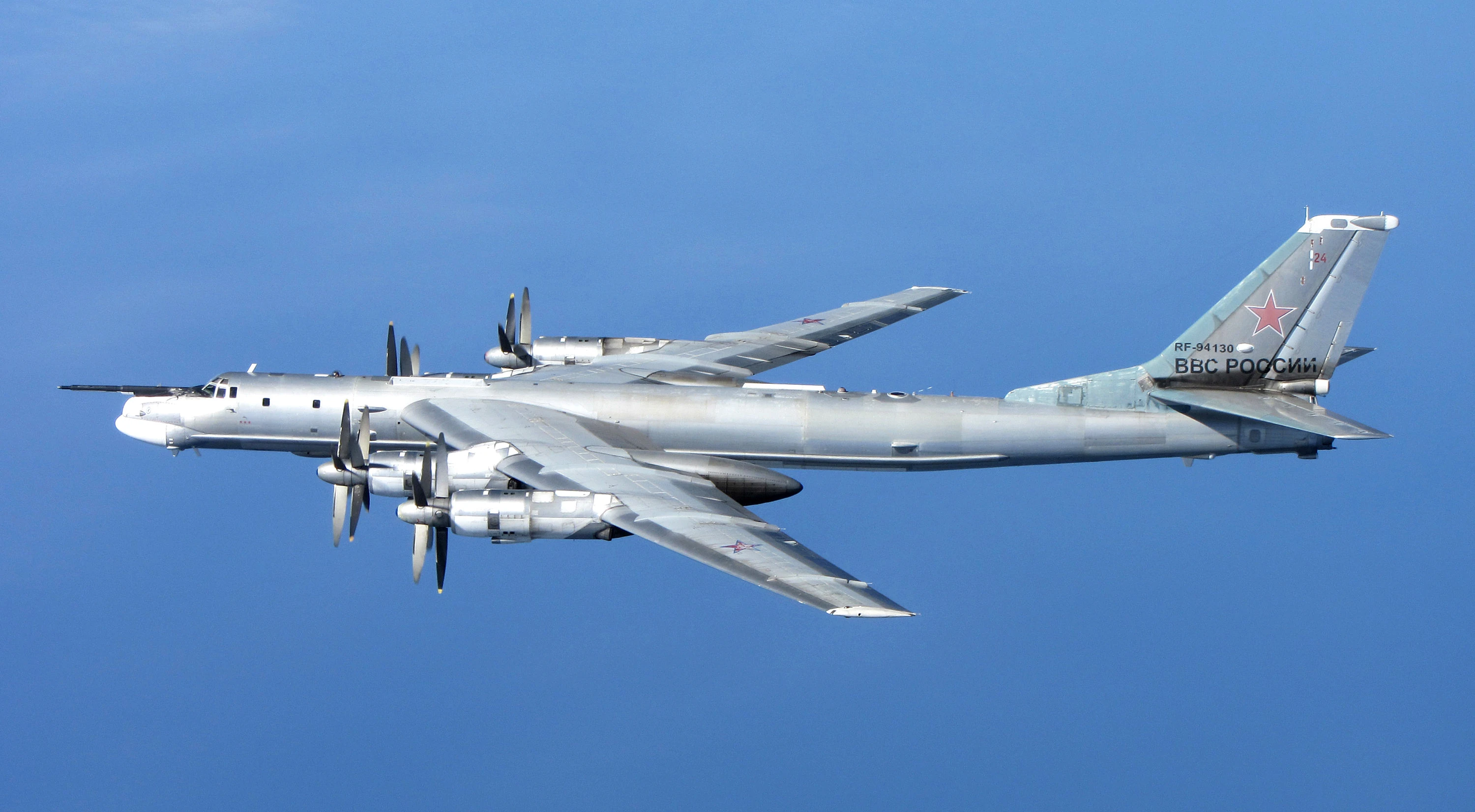
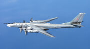
Tu-95MS Bear H RF-94130 off Scotland in 2014. The soviets also used them.

The OTL Soviet/ ATL remnant Soviet flag.
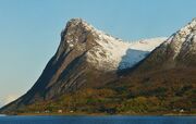
Mount Toppen (759 m) as seen from the southeast near Harstad from a Hurtigruten ship (M/S Polarlys) in 2009 October. This near shear mountainous sea cliff proves why the Soviets would have had difficulty taking the region by means of a amphibious assault during the Cold War! They would have either come over a land border from a neighbouring nation or as paratroopers from aircraft.
During the Soviet Era the Rybachy Peninsula was a major military staging post, but this has now all gone. Non the less, as of 2005 the territory is still closed to foreigners. Tersky Coast Is still a closed zone that requires non-locals to get a FSB visa to enter.
Domination of the Greenland, Barnet's and Norwegian Seas was seen as crucial to winning the war in Europe. Securing the control of Norway's northern ports would also significantly expand the number of ports the Soviets had in the region. Adolph Hitler twigged this when he invaded Norway and Denmark in WW2, since Germany had a repetitively small coastline back then, and it became smaller still with the loss of East Prussia in 1945.
The Soviet's Northern Fleet was established as part of the Soviet Navy in 1937 and operated more than 200 submarines ranging from diesel-electric attack (SS) to nuclear-powered ballistic missile (SSBN) classes during the Soviet Era. A civilian Northern Fleet also existed prior to the Second World War and the Historic, pre-Bolshevik mixed civil/military Northern Fleet was in operation there from ~1707 to 1918 All these Northern Fleets had their HQs located at Severomorsk and their main ports at Murmansk.
The Northern Fleet had its main Cold War base was Severomorsk with 6 more naval bases at Polyarnyy, Olenya Bay, Gadzhiyevo (Yagelnaya/Sayda), Vidyayevo (Ura Bay and Ara Bay), Bolshaya Lopatka (Litsa Guba), and Gremikha. Arktika nuclear-powered icebreakers are based at Murmansk. Shipyards are located in Murmansk, Severodvinsk, Roslyakovo, Polyarnyy, Nerpa, and Malaya Lopatka. The fleets' Spent fuel storage sites include Murmansk, Gremikha, Severodvinsk and Andreyeva Bay. They are all in and about the Kola Peninsula region of north western Russia and are still operational to various degrees, as are remaining the local radar and radio interception stations.
Murmansk harbour is also used for scrapping unwanted and surplus ex-Soviet atomic submarines. Severomorsk had by the 1980s and still has the largest dry dock on the Kola Peninsula. It is also a major ammunition storage site for the Northern Fleet. Between 200 and 300 people died as at least 1/3 of the fleet's surface-to-air missiles supplies 'mysteriously' caught firer and blew up over 5 days in a depot on the outskirts of Severomorsk, on May 13, 1984.
Some Norwegian forces would also go to the south and east because a few Polish and E. German units would eventual peculate out of a by the conquered Denmark and in to the southern tip of Norway and Sweden, while some Soviet forces would also have entered via Sweden, if Sweden was invaded, by this time.
The plan was presumably current until the early 1960s when nuclear arms complicated the situation greatly, although it could still be of use in a non-nuclear war or a limited targets nuclear war.
After the fall of northern Norway, was completed the GIUK gap would be open to a hostile Soviet take over. The Soviet invasion of Jan Mayen Island and the Norwegian/Russian mining colony of Spitsbergen would soon follow, leading to the capture of the NATO held LORAN-C Station, near Olokin City (which is in fact only a small village) would happen. This would probably be leading up to to the eventual Soviet invasion of Iceland.
The Soviet's Operation Northern Norway would have taken over Ivalo Airfield and other parts of northern Finland for strategic purposes.
Norway's counter plan[]


Feather ice on the plateau above Alta, Norway at 70ºN. Forms when night temperature drops below −30°C (i.e. −22°F)


View of the Hardangervidda plateau, Norway.
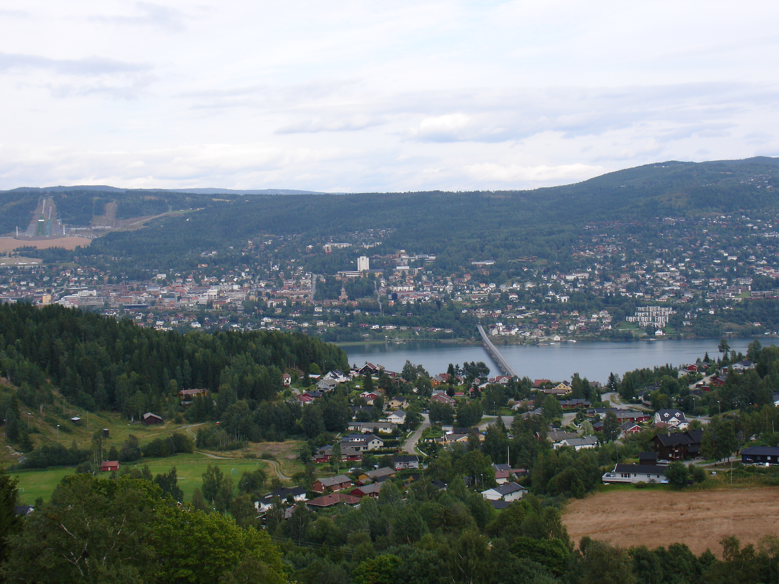
Lillehammer, Norway. The ski jump build for the Olympic Winter Games in 1994 is visible to the left.

The flag of Norway.
Norway was prepared for all-out war in case of a Soviet invasion. Never again did they want an invasion like that of 9 April 1940, when the Germans surprised an unprepared and neutral Norwegian nation. This was one of the reasons they were one of NATO's founding nations.
Nazi Germany's German Kriegsmarine also used near by Kirkenes in Norway as a port and 11 local resistance fighters who helped the Norwegian partisans collect information about the German occupation forces were executed in the August of 1943. In 1942 there were also massacres of POWs at Beisfjord and Bjørnfjell. The Nazis destroyed most of Sør-Varanger Municipality, along with the rest of Finnmark, in the Lapland War and Operation Nordlicht of 1994-1945.
The USSR briefly occupied the region after the war on friendly turms and then gave it back to Norway. The local iron mine was destroyed in 1944 and not rebuilt until 1946 and the Kirkenes–Bjørnevatn_Line tat served it was closed for maintenance until 1952.
The Norwegian government was planning to give up on the the northern region of Finnmark in the event of an invasion by the Soviet Union in order to buy time to organise a decisive counterstrike.
One of the 1,000 Soviet air planes intercepted were by Norwegian fighters outside the coast of Norway every year from a undisclosed time in the in the 1960s to a undisclosed time in the in the 1980s. In 1972 over 1,500 Soviet aircraft were intercepted and escorted out of NATO airspace by NATO's Nordic Air Policing Unit. Many flew over Bodø. Soviet Backfire bombers armed with a nuclear capable cruise missiles flew over the region in later years.
Bodø, Bardufoss, Andenes, Frøy, Tromsø, Lakselv and Kirkenes were all targets. The attack would involve a massive land, sea and air assault. Some northern locations in northern Finland like Kittilä municipality would be taken by airborne troops to help encircle the Norwegian province of Finnmark if the Finns had refused to co-operate with the Soviets.
Finnmark had been was devastated by the retreating Nazi Germans in 1945 and rebuilding was not completed, so at a meeting in 1951 between army chiefs and the defence, the famed resistance World War 2 hero Jens Christian Hauge, proposed to devastate and abandon Finnmark in such an event in order to make the forward march of the Soviets more difficult.
The army’s troops would then be mobilise en mass in the neighbouring county of Troms, joined by allied soldiers trained to fight in Norwegian conditions, and attempt to hold off the Soviet invaders there as NATO came to there aid. Some Norwegian forces would also go to the south and east because a few Polish and E. German units would eventual peculate out of a by the conquered Denmark and in to the southern tip of Norway and Sweden, with some Soviet forces and entering via Sweden, if Sweden was invaded, by this time.
The plan was presumably current until the early 1960s when nuclear arms complicated the situation greatly, although it could still be of use in a non-nuclear war or a limited targets nuclear war.
After the fall of northern Norway, was completed the GIUK gap would be open to a hostile Soviet take over, eventually leading to the Soviet invasion of Iceland would then probably have occurred. The Soviet invasion of and the Norwegian/Russian minig colony of Spitsbergen and Jan Mayen Island would have also soon followed the fall of northern Norway, leading to the capture of the NATO held LORAN-C Station, near Olokin City (which is only actually a small village). There would have been a few Norwegian and NATO troops as security guards, but no major troop numbers since the island is so small on Jan Mayen and the hostile polar climate on Spitzbergen.
The Loran-C network is a hyperbolic military and civil radio navigation system which allows a receiver to determine its position by listening to low frequency radio signals transmitted by fixed land-based radio beacons.
Covert American submarines[]
Americans subs loitered around Russia's (then the USSR's) Kildin Island since the mid 1960s to spy on Soviet activity in Murmansk and it's dependent facilities. This kind of submarine surveillance missions were referred to during the Cold War as "Operation Holy Stone"; submariners nicknamed the program "Operation Pinnacle" or "Operation Bollard".
The forces[]
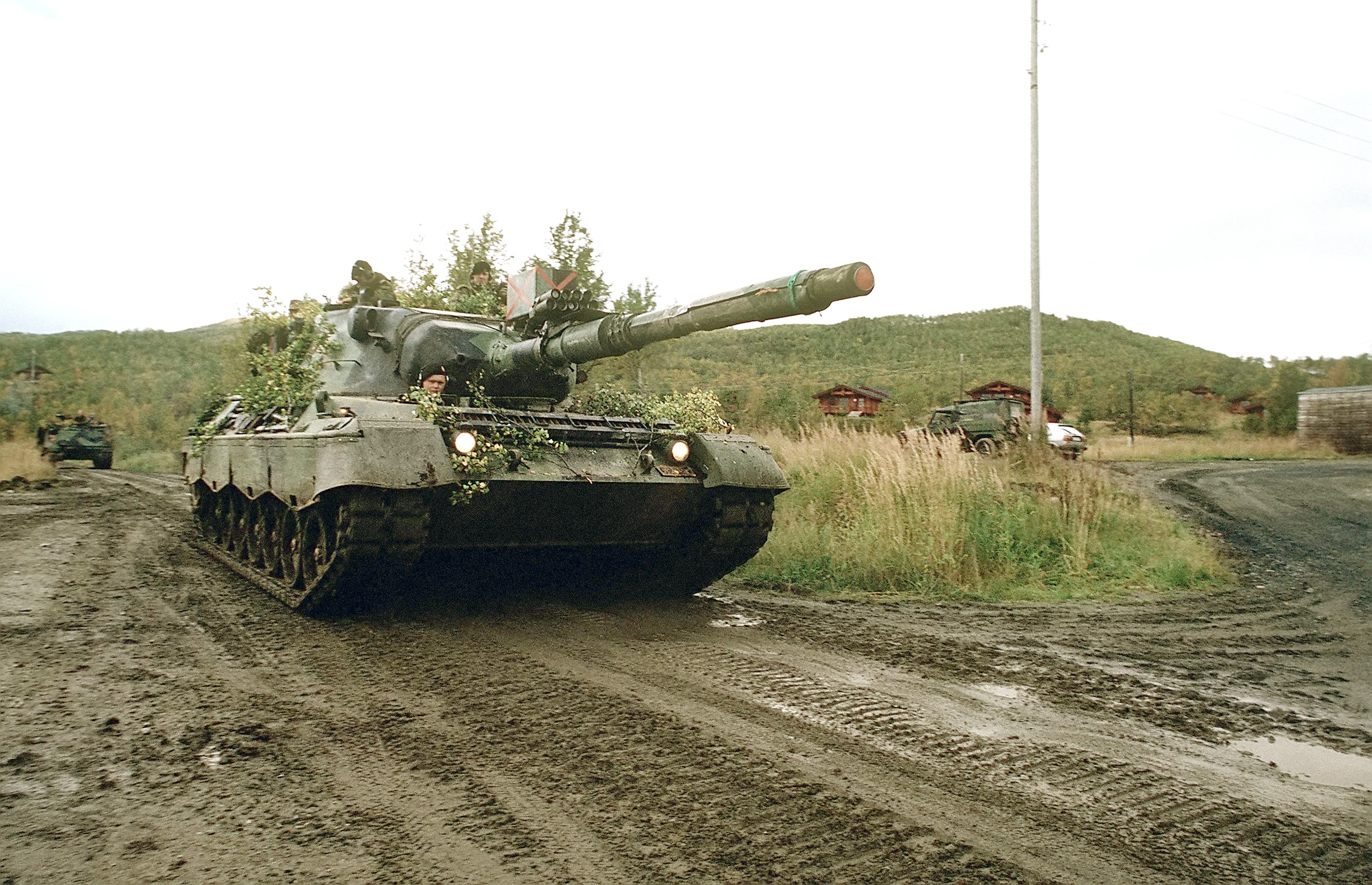
A Norwegian LEOPARD 1A1A1 main battle tank during the Norwegen part of Exercise Teamwork '88.

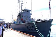
KNM Alta was a minesweeper in the Royal Norwegian Navy from 1966 to 1996. It is now a museum ship in Oslo.
It would have involved an all out assault by the Soviet forces in the Kola Peninsular and Karelia. They would have hrown everything at it in order to see off any threats to there bases in the Kola Peninsular. The navy, airforce and army were all to be used on mass in such an assult.
Whilst Norway did not want to initiate such a conflict it would have fallen back and abandoned Finnmark. Later they would have launched an all out attack to liberate it with NATO help. The military war games like Exercise Teamwork '88 was run to address these issues.
A secret underground base was built in Lyngen during 1996.
Bunkers and signal interception stations[]

Falkland islands Battle Documentary - War Between England and Argentina - Documentary Films Channel-0
Falkland islands Battle Documentary - War Between England and Argentina - Documentary Films Channel.
The battle ready Norwegian forces were built up and kept prepared at bases in Bardufoss, Setermoen and Skjold, all part of the Troms region, along with a series of coastal defences, radio eaves dropping systems and radar arrays to monitor air and sea movements.
The satellite signal interception station at Fauske (Fauske II), Norway was vital in giving the British intelligence information regarding Argentinian fleet locations during the 1982 Falklands War.
Stuff like military equipment, arms, supplies and fuel were spread all over the country, often hidden in civilian buildings such as cottages, garages, storage buildings and alike. The Frøy defence line was a strong infantry line built between 1950 and 1990.
A secret underground base was built in Lyngen during 1996.
The British army had a training and recreational facility at Isefjaer near to Kristiansand in 1961, near a abandoned Nazi German complex which consisted off underground several large guns and store-rooms cut into the mountain to keep ammunition and other explosives.
The Soviet side of the border had several major bunkers, several signal interception stations and hundreds of 'pill box' type bunkers on it.
Video[]

DEADLY PREDATOR Norwegian Army Lepard 2 Main Battle Tank-0
DEADLY PREDATOR Norwegian Army Lepard 2 Main Battle Tank!

Cold war command bunker
Cold war command bunker?

.jpg)
Also see[]
- NATO defensive fortifaction lines
- Exercise Reforger
- Exercise FleetEx '83
- Operation Chrome Dome
- Exercise Able Archer '83
- Exercise Zapad-81
- Exercise Northern Viking
- Germany's Fulda Gap
- Swedish pseudo-neutrality
- Finnish pseudo-neutrality
- The Swiss National Redoubt (1880-2010)
- Seven days to the River Rhine (1979)
- Mineral mining, smelting and shipping videos
- Soviet invasion of Greenland
- Mirny Diamond Mine
- Nickel
- Soviet invasion of Denmark
- Exercise Teamwork '88
- Minerals and fuel in central Africa
- Operation Square Leg (1980) and Exercise Hard Rock (1982)
- French nuclear plans and the Force de Dissuasion
- North German Plain
- The southern Danube route
- Soviet/NATO invasion of Finland
- The week of war policy
- Operation Gladio
- Nicaraguan Civil War
- Korean Demilitarized Zone
- Berlin Wall and Checkpoint Charlie
- Greece, Turkey and southern Italy
Links[]
- http://coldwarsites.net/country/norway/
- http://coldwarsites.net/country/sweden/
- http://www.newsinenglish.no/2011/02/04/cold-war-defense-included-plans-to-sacrifice-finnmark/
- http://en.wikipedia.org/wiki/Finnmark
- http://en.wikipedia.org/wiki/Kola_Peninsula
- http://www.visittromso.no/en/
- http://en.wikipedia.org/wiki/Severomorsk
- http://en.wikipedia.org/wiki/Troms%C3%B8
- http://en.wikipedia.org/wiki/Rybachy_Peninsula
- http://en.wikipedia.org/wiki/Nikel
- http://en.wikipedia.org/wiki/Events_leading_to_the_Falklands_War
- http://en.wikipedia.org/wiki/Falklands_War
- http://en.wikipedia.org/wiki/Mountain_ranges_of_Norway
- http://en.wikipedia.org/wiki/Soviet_Naval_Aviation
- http://en.wikipedia.org/wiki/Northern_Fleet
- http://wonderfulengineering.com/10-secret-underground-bunkers-around-the-world-that-will-save-your-life-during-a-nuclear-war/
- http://walyou.com/secret-weapons-that-were-never-completed/?utm_source=zergnet.com&utm_medium=referral&utm_campaign=zergnet_60163
- http://en.wikipedia.org/wiki/Tersky_Coast
- http://en.wikipedia.org/wiki/Rybachy_Peninsula
- http://www.britannica.com/EBchecked/topic/1574468/Rybachy-Peninsula
- http://barentsobserver.com/en/business/2015/03/developing-tourism-and-reindeer-husbandry-rybachy-peninsula-05-03
- http://barentsobserver.com/en/business/2015/04/mega-polluter-pays-record-high-dividends-13-04
- http://en.wikipedia.org/wiki/Kola_Peninsula
- http://en.wikipedia.org/wiki/Khibiny_Mountains
- http://en.wikipedia.org/wiki/Lapland_War
- http://en.wikipedia.org/wiki/Sydvaranger
- http://en.wikipedia.org/wiki/Troms
- http://en.wikipedia.org/wiki/Troms%C3%B8
- http://en.wikipedia.org/wiki/Bj%C3%B8rnevatn
- http://en.wikipedia.org/wiki/Bj%C3%B8rnfjell,_Nordland
- http://en.wikipedia.org/wiki/Kirkenes
- http://www.visitnorway.com/en/where-to-go/north/kirkenes-and-eastern-finnmark/
- http://en.wikipedia.org/wiki/Kirkenes
- http://www.visitnorway.com/en/where-to-go/north/kirkenes-and-eastern-finnmark/
- http://en.wikipedia.org/wiki/Sydvaranger
- http://en.wikipedia.org/wiki/Kirkenes%E2%80%93Bj%C3%B8rnevatn_Line
- http://en.wikipedia.org/wiki/Kildin_Island
- http://en.wikipedia.org/wiki/Bj%C3%B8rnevatn
- http://en.wikipedia.org/wiki/Submarine_incident_off_Kildin_Island
- http://en.wikipedia.org/wiki/Harstad
- http://en.wikipedia.org/wiki/Pechengsky_District
- http://en.wikipedia.org/wiki/Kola_Norwegians
- http://en.wikipedia.org/wiki/Murmansk
- http://en.wikipedia.org/wiki/Loran-C#Loran-B_and_-C
- http://en.wikipedia.org/wiki/Longyearbyen
- http://en.wikipedia.org/wiki/Spitsbergen
- http://en.wikipedia.org/wiki/Jan_Mayen
- http://en.wikipedia.org/wiki/Svalbard
- http://en.wikipedia.org/wiki/Barentsburg