Data[]
| Category. | Statistic. |
|---|---|
| Launch vehicle. | Thor DM-18 Able II. |
| Launch date. | 1st of April, 1960. |
| Launch site. | Cape Canaveral LC-17A. |
| Ceased operations. | 15, June 1960. |
| Owner(s). | NASA. |
| Major contractor(s) | RCA Astro. |
| Is it still in orbit. | N/A, but probably yes. |
| Launch mass | 122.5 kilograms (270 lb). |
| Nationality(s). | American. |
| Satellite type. | Weather satellite. |
| Links. | http://www.wikiwand.com/en/TIROS-1, http://science.nasa.gov/missions/tiros/, http://www.lib.noaa.gov/collections/TIROS/tiros.html and http://www.geog.ucsb.edu/~jeff/115a/history/tiros1.html. |
History[]
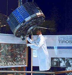
TIROS-1 prototype on display at the Smithsonian National Air and Space Museum.
TIROS-1 was the World's first ever weather satellite and was sent up in the hope it may help hurricane detection work back on earth. Vanguard 2 did also take several low quality pictures of clouds between 1959 and 1969. The optical scanner experiment was designed to obtain cloud-cover data between the equator and 35° to 45° N latitude.
It is to be noted that modern services like Google Maps, hurricane tracking services and satellite TV all owe a debt to these early satellites.